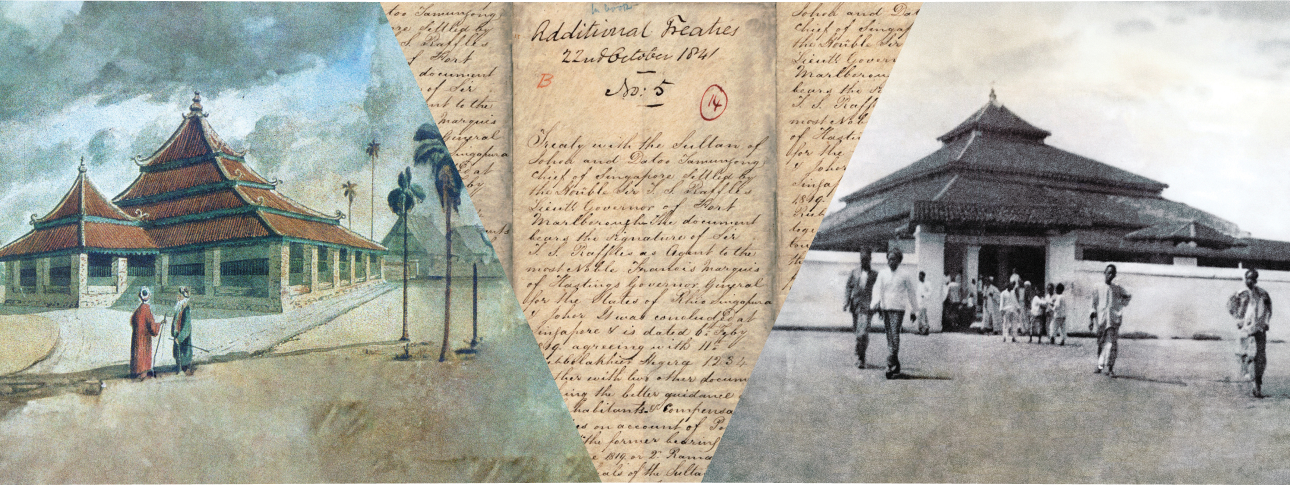
In 1822, Singapore's British colonialists granted Sultan Hussein Shah 56 acres of land at Kampong Glam. In 1848, his eldest son, Tengku Ali, who later became Sultan Ali Iskandah Shah, granted some of this land to be used for the burial of Indian Muslim residents of Kampong Glam and other parts of Singapore.
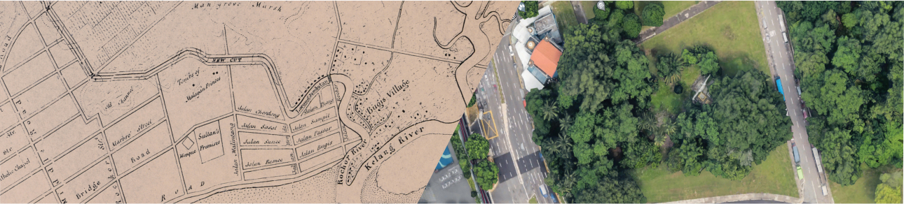
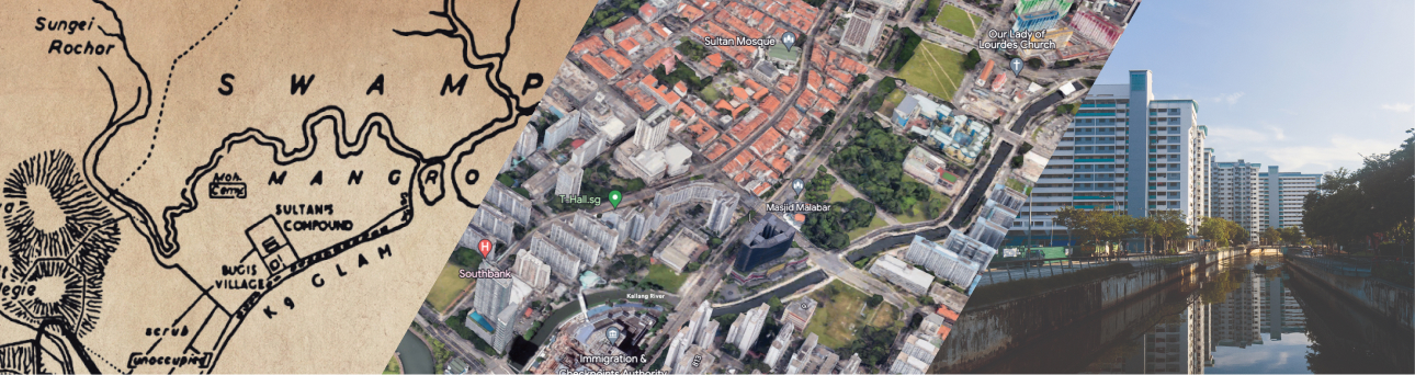
The burial ground, spanning about three-quarters of an acre, was located at the junction of Victoria Street and Jalan Sultan. Tengku Ali, envisioning a sacred resting place, designated the landward side near the tomb facing Campong Boyan Baru and the public road for burials. Over time, part of the burial ground was used to build a mosque, which is where Malabar Mosque stands today.
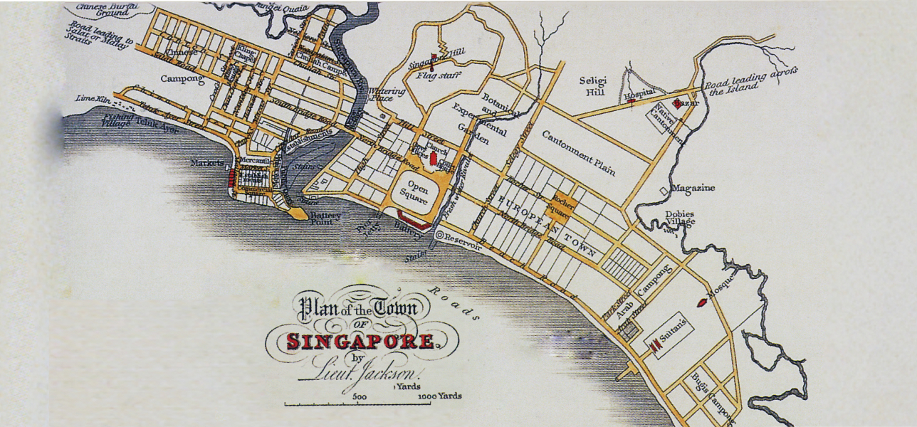
Soon after Stamford Raffles founded modern Singapore in 1819, Kampong Glam became a vibrant cosmopolitan hub for residence, as well as for commercial and trading activities. Kampong Glam was also home to Malay royalty.
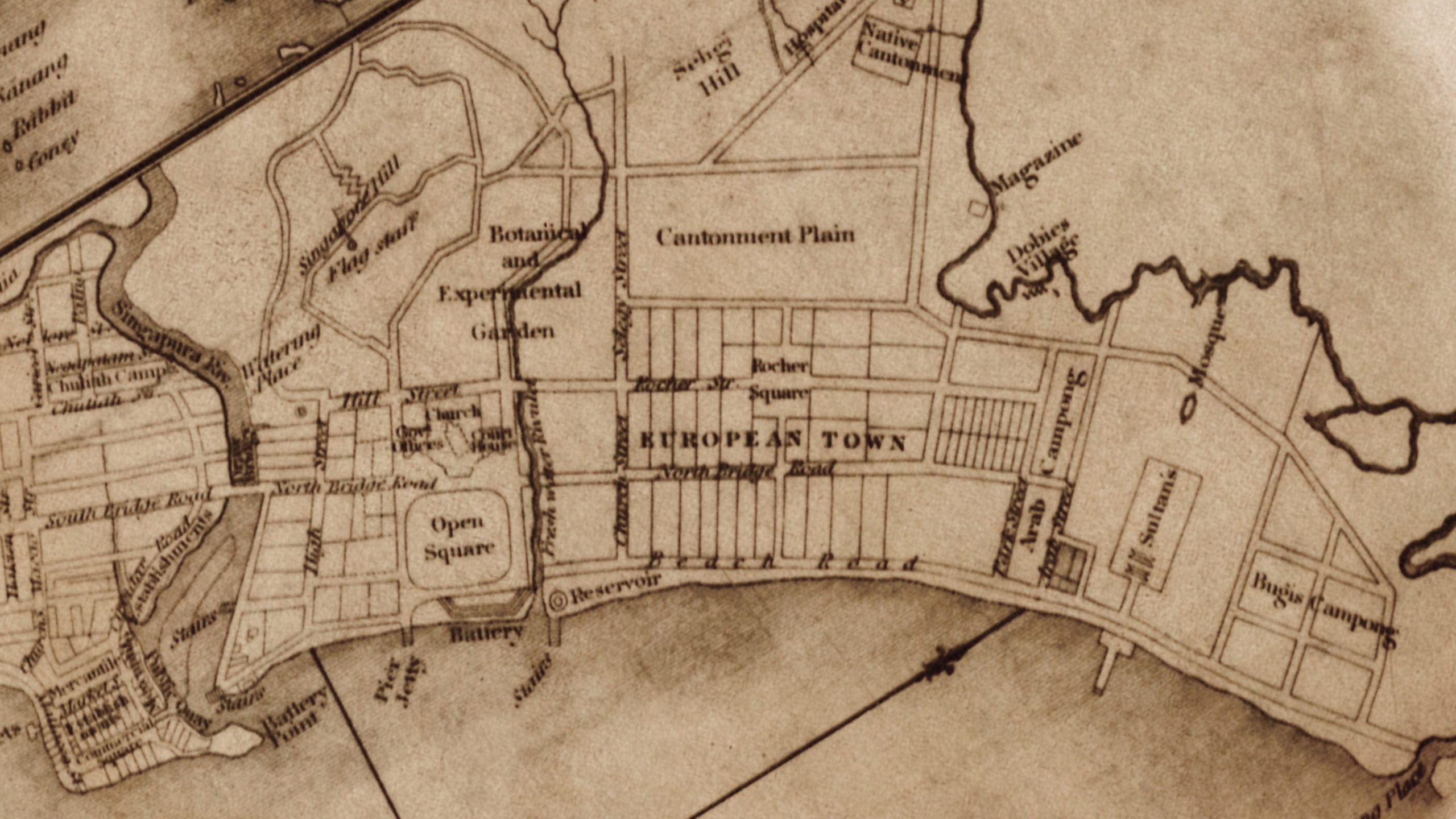
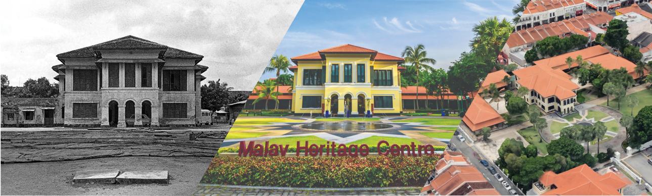
Around May 1819, Sultan Hussein Shah, the newly appointed ruler, constructed his istana or palace at Kampong Glam for his royal household. In 1822 as the British strengthened their territorial control over Singapore, Raffles allocated Sultan Hussein 56 acres of land in Kampong Glam. The area extended from the east of the European town and included the land between Rochor River and the sea. The royal cemetery lay within this area. One of the notable landmarks in this vicinity is the Sultan Mosque, closely associated with Sultan Hussein’s legacy.
Near Sultan and Malabar Mosques lies Hajjah Fatimah Mosque. Located along Beach Road, this historic mosque dates back to 1845–1846, making it one of Singapore's oldest. Its origins trace back to the generous contributions of Hajjah Fatimah, a native of Malacca who married a Bugis prince. Built with the land she donated, the mosque created a sacred space where the Malays, Bugis, and Arabs from the neighbouring kampongs would gather in prayer.
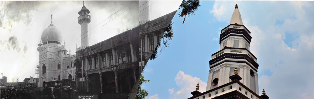
Malabar Mosque is situated in Kampong Glam, an area of historical significance. Prior to the British establishment of modern Singapore in 1819, Kampong Glam was populated by the Orang Gelam tribe at the mouth of the Rochor River. Named after its inhabitants, the area was characterised by its swampy and jungle-like surroundings.
As the British presence and urbanisation took hold, Kampong Glam underwent notable changes. In 1824, a road was built running through Sultan Hussein’s compound, the street where the Mosque would later be built.
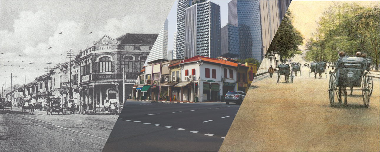
Initially known as Rochor Street in the 1820s and Marbro Street in the 1830s, it was then re-named Victoria Street in honour of Great Britain’s Queen Victoria.
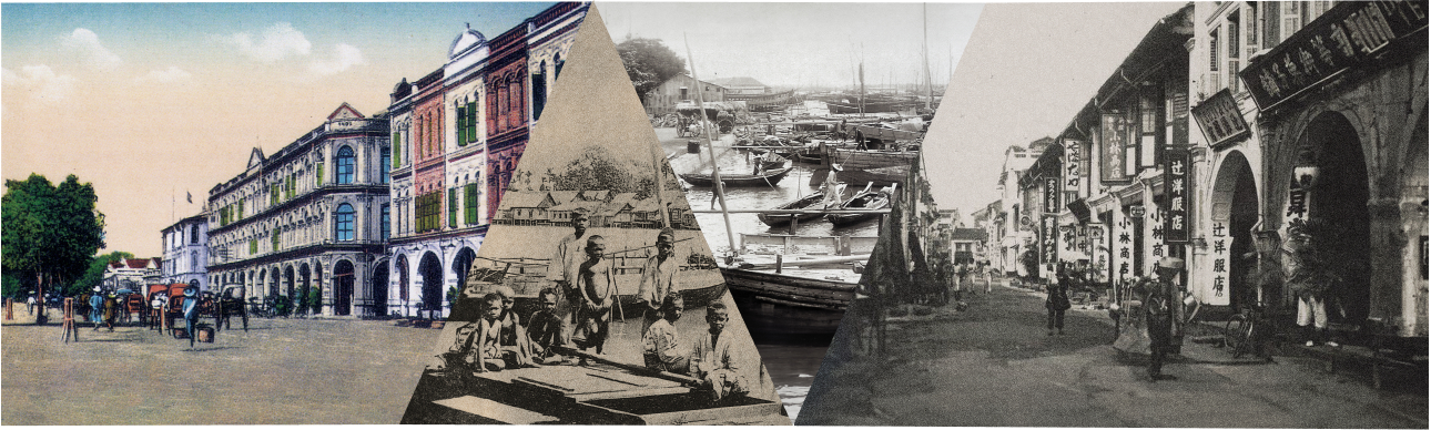
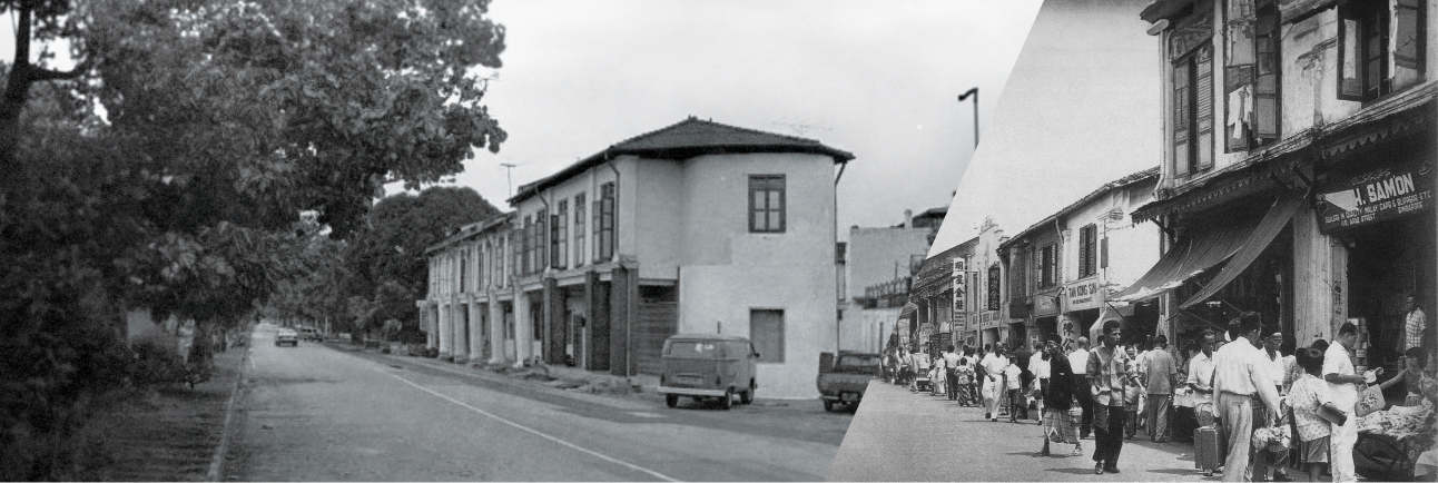
Throughout the early 20th century, the landscape transformed and new shophouses and residential buildings emerged. These developments shaped the physical fabric of Kampong Glam, contributing to its unique historical and architectural character that can still be appreciated today. North Bridge Road was first constructed in 1827.
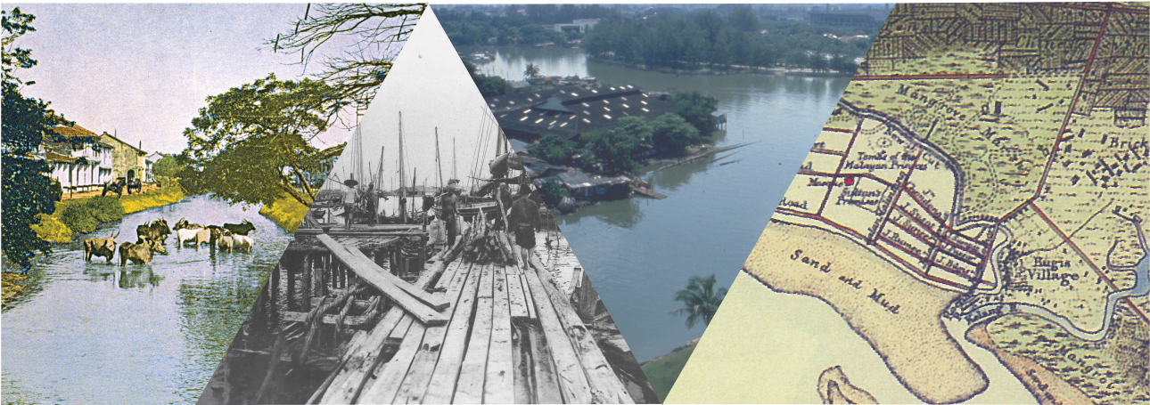
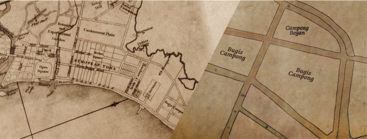
In 1822, Stamford Raffles envisioned a well-planned town that spanned from the Singapore River to the Kallang River. His plan included allocating plots of land for different activities and ethnic communities, and identified Kampong Glam as a Muslim quarter for the Arab and Bugis communities. The Arab influence in Kampong Glam extended beyond the presence of this community. During the 1910s, streets were named after Arabian cities, such as Bussorah Street, where sandal makers and coppersmiths plied their trade, and Baghdad Street, where Chinese stone masons and tomb carvers were found.
Aligned with Raffles’ town plan, the Bugis were relocated from their trading quarters near the Sultan’s residence to Kampong Rochor along the river. As a trading centre, Kampong Rochor attracted the Baweanese, Banjarese, people from Palembang and the Javanese. Kampong Jawa, enveloping Haji Lane and Arab Street, became the trading point for Javanese craftsmen and merchants in the 19th century. Kampong Glam was not only a commercial and trading hub, it was also a fashionable locale for Europeans living in beautiful villas by the beach.
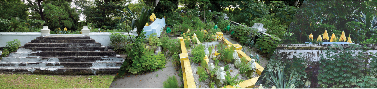
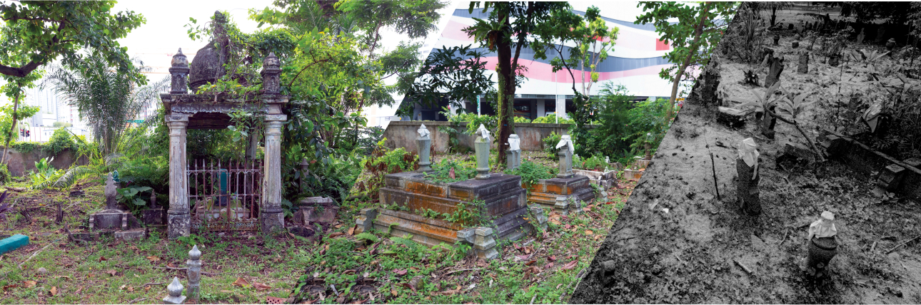
Jalan Kubor Cemetery, located along Victoria Street, is Singapore’s oldest Muslim cemetery. It encompasses three sections: the old Indian Muslim cemetery, the Malay Burial Ground, and the Sultan’s Burial Ground. Jalan Kubor Cemetery is also the resting place for Singapore’s community leaders, and traders and merchants from the region. Gravestone inscriptions found there in languages and scripts such as Arabic, Malay, Javanese aksara, Bugis aksara, Gujarati, English and Mandarin showcase Singapore’s multiculturalism. Among the notable features of this cemetery are the elevated Tombs of Malayan Princes, also called the Royal Mound. This area preserves the graves of Malay royalty such as Tengku Aisyah Binte Tengku Alam, the great-granddaughter of Sultan Hussein. Adjoined to the Sultan’s Burial Ground is the Malay Burial Ground, which is situated near Rochor Canal and reflects the cemetery’s Arab connections through names like ‘Syed Omar’s burial ground’ and ‘Aljunied burial ground’.
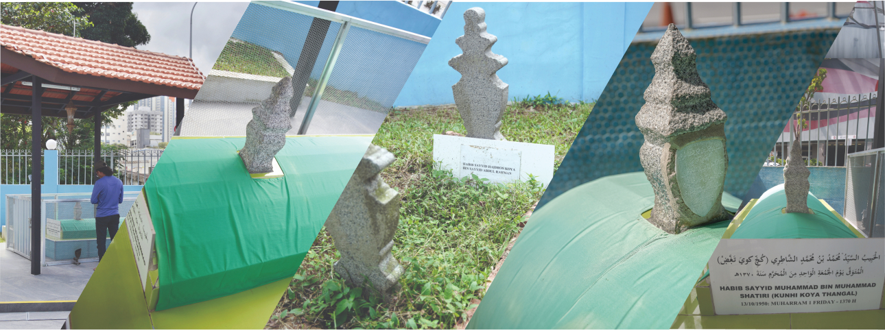
Within the vicinity of Malabar Mosque, on the South Indian Muslim plot, rest the tombs of Malabari saints and other notable figures. Amongst them are Habib Sayyid Muhammad bin Muhammad Shatiri, or Kunhi Koya Thangal, and other descendants of Prophet Muhammad such as Habib Sayyid Ibrahim Haidros Muttu Koya Thangal and Habib Sayyid Haidros Koya Thangal bin Sayyid Abdul Rahman.
In 1987, Singapore Land Authority acquired the Cemetery. This vast burial ground, spanning about five football fields, was gazetted under the Urban Redevelopment Authority’s masterplan for residential use in 1998. However, recognising the heritage value of the 19th century cemetery and its connection to Singapore’s Malay world, the National Heritage Board conducted a study in 2014 to document the cemetery’s history and the stories of those laid to rest there. Given the cemetery’s rich historical value, Singapore’s heritage community continues to ensure the preservation of the cemetery.